
“At the edge of the land of Kazakhstan”
One of the most mysterious places in the world - Altai.
The most eastern point of Kazakhstan - Katon Karagai district - occupies north-eastern part of East Kazakhstan region and is located at the border of 2 states.
On north and noerth-east the district borders Ust-Koksinsky and Kosh-Agachskiy districts of Altai Republic (Russia), in south-east - Altai district of Xinjiang Uygur Autonomous Region in China.
It’s only 40 km from the most eastern point of the Katon-Karagai district to the border of Mongolia.
When you travel around Katon-Karagai district, you can see not only Kazakhstan’s nature, but also parts of the neighboring countries.
In clear day, from Burkhat mountain pass that is located on an old Austrian road, you could see Katun ridge on the territory of Russia.
And from Mramorniy (“marble”) pass you will have a good view of Akkum and Blandykum sand dunes in Western China.
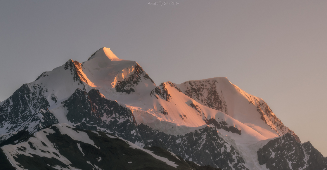
Toponymics
It is hard to say for sure how the name Katon-Karagai came to life. We know that it was started to be used in ~ 1871, because that was the name of the administrative district’s center.
Books about East Kazakhstan’s toponymics contain some information about Katon-Karagai toponym - there was a huge pine forest near Katon-Karagai village (“pine” in Kazakh - “karagai”). And the land is called “Kotón” in Kazakh and Kalmyk languages. This is how the name “Katon-Karagai” appeared.
Local old men say that there are multiple ways of the name’s origin. There is a version that Katon comes from a Kalmyk word “Katyn”, which means “first wife of a man, reputable woman”. And “karagai” in Kalmyk - wooden fence. This is another way that you can interpret Katon-Karagai - a reputed woman behind a fence. Perhaps it meant (or was) a safe place for a woman.
RELIEF AND CLIMATE
The landscape here consists mostly of mountains. Katon-Karagai district is surrounded by mountain ridges: Narymskiy, Sarymsaqty, Tarbagatai, South Altai, Listvyaga, Katun
The district is divided onto 4 climate zones:
– High mountains (tundra and meadows)
– Mountain forest, very humid
– Forest-steppe zone, humid
– Mountain-steppe
Climate of high mountain and mountain forest zones is very humid, moderately cold and arctic in some places.
It can be really hot in summer, and in winter the temperatures sometimes go down to -45C. This sharp climate owes its formation to geographic location of Altai mountain systems. This area is located at the confluence of different landscapes: high mountains, meadows, forests, valleys, tundra and plains. Mountain tops are covered with massive layers of ice, thus Katon-Karagai has a lot of mountain rivers and springs.
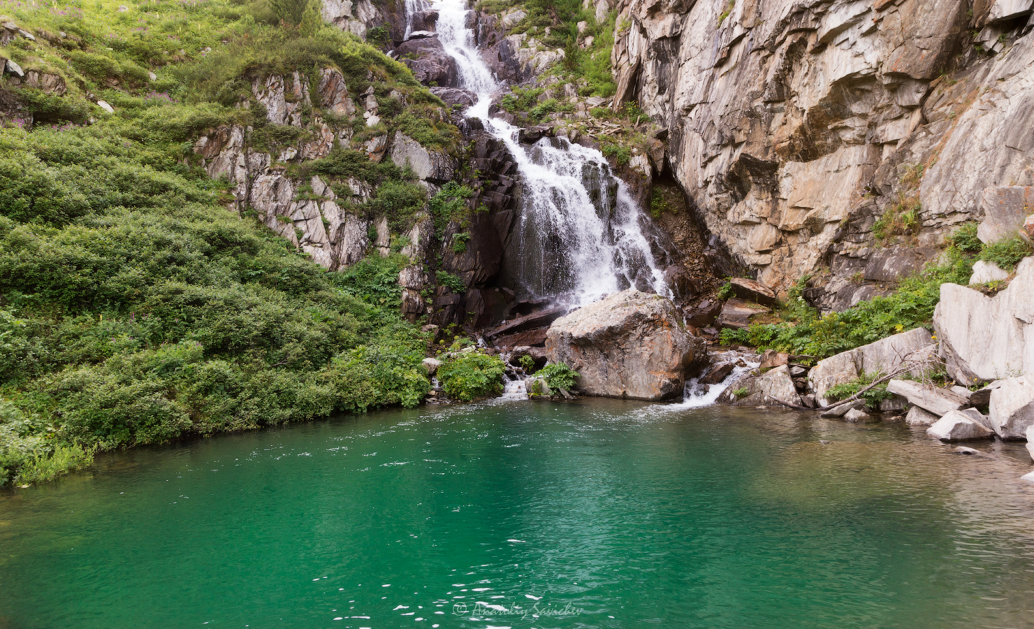 Водопад на "Сарымсыкты"
Автор фото: Анатолий Савичев
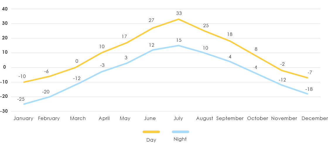
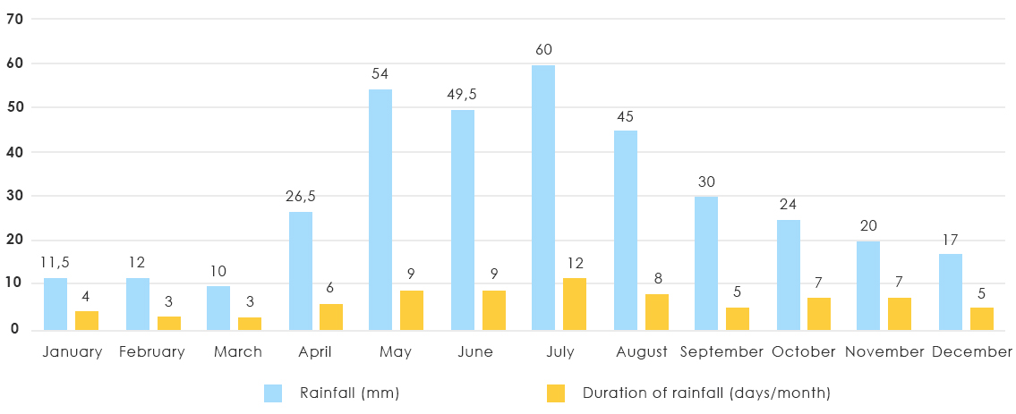
In simple language - the weather in mountains and in village can differ, and this is one thing to consider when planning your trip. Night temperatures in mountains are usually much colder. Daily changes of temperature are quite sharp, and rains can go up to several days in a row
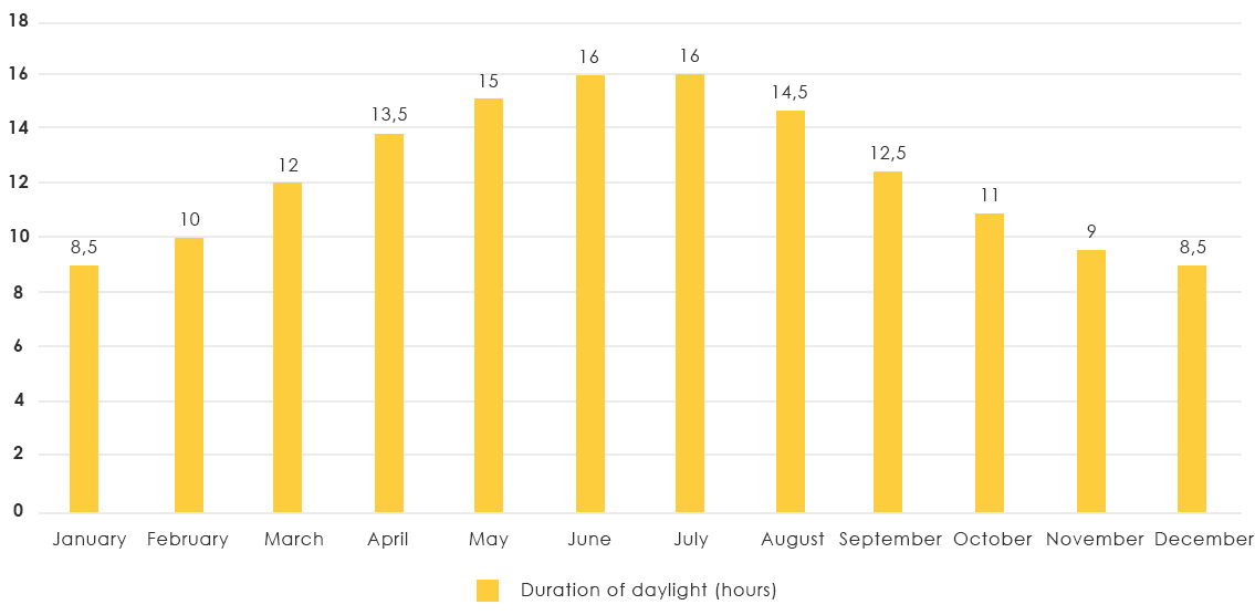
We prepared the most important information for the travelers in form of simple graphs: Average annual temperature, rainfall and duration of daylight.
Several tips:
When planning your trip to Katon-Karagai, we recommend to check the weather forecast for the period of your visit on Gismeteo website
We also recommens to check the list of clothes that you might need for comfortable trip and good time in Katon-Karagai.